Laser distance measuring device with inertial sensors
As part of a CTI project (2016 - 2017), Leica Geosystems AG, together with the ISC at ZHAW, has developed a new laser distance measuring device with inertial sensors (IMU) and the associated algorithms.
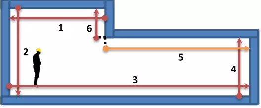
When measuring rooms using a laser distance meter, the successively acquired measured values must be brought into a uniform stationary coordinate system and displayed. The algorithms developed at the ZHAW Institute of Signal Processing and Wireless Communications (ISC) fuse the measurement data using inertial sensors in the measuring unit, thus enabling the automatic drawing of floor plans on a tablet or smartphone. With the newly developed "Smart Room" function, which is available in the Leica DISTO™ Plan app, the measured values can be recorded clockwise or counterclockwise. Each distance can be measured either forwards or backwards, depending on accessibility or the availability of reference surfaces. The data is transferred via Bluetooth Smart, so the tablet / smartphone does not necessarily have to be held in the hand during the measurements.
Product
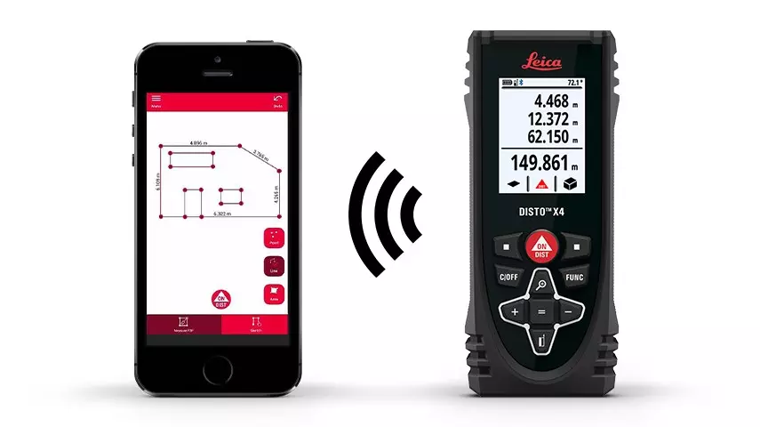
The finished products "DISTOTM X4" and "DISTOTM X3" from Leica Geosystems AG, together with the "Smart Room" function, make measuring a room much easier. The manual drawing of the floor plan and the assignment of distance measurements are completely eliminated. This greatly shortens the workflow and reduces the sources of errors such as the incorrect assignment of distances.

At a glance
Participating institutes and centers:
Project partners:
Funding: CTI (from 2018: Innosuisse)
Project status: finished