Digital Environment Specialisation
We are facing extremely urgent environmental challenges. Big data provides us with important answers to these complex questions. Learn to find data-based solutions to protect our environment.
The compulsory modules in the Digital Environment specialisation focus on environmental, agricultural and forestry systems. In order to improve the quality of life for humans, plants and animals, you will learn to combine technical knowledge (e.g. research methods) with an understanding of the systems, e.g. mutual influences between humans and insects. This will lead to data-based insights that are much more meaningful than qualitative considerations. This specialisation is offered in close collaboration with the Institute of Natural Resource Sciences IUNR.
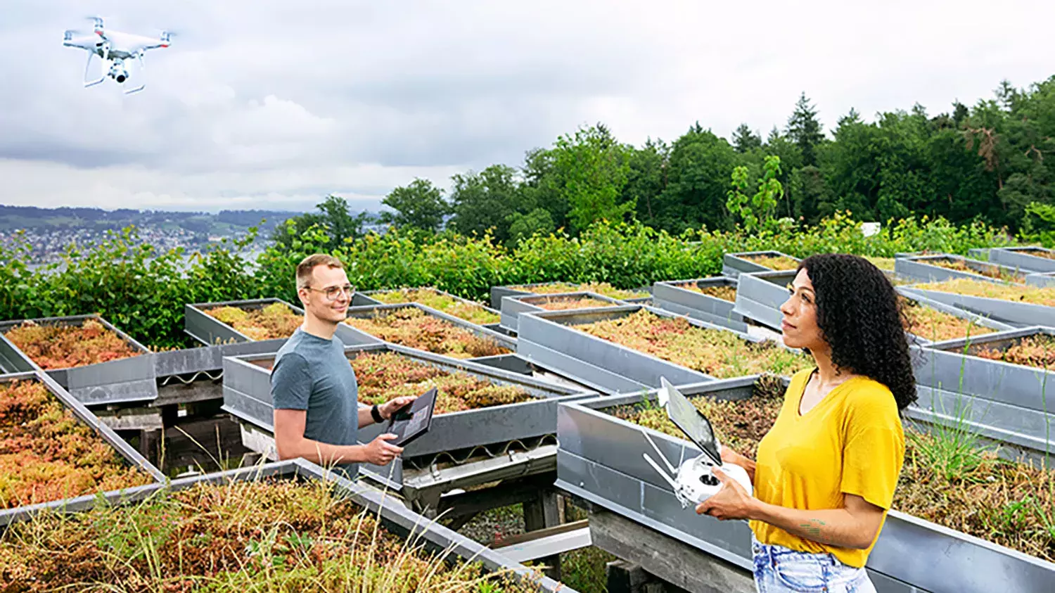
For example, you can learn about research methods such as the analysis of spatio-temporal data. Drones with cameras that sense different wavelengths can systematically fly over a forest, thereby creating a map (spatial data) of the tree population and/or of tree diseases. If the flights are repeated regularly, it is also possible to record the development over time, and to see how the map changes. There are also systems in which the spatial component is three-dimensional (e.g. atmospheric data with its height stratification).
Example of an important area of application: This specialisation will make you an expert in the examination of environmental problems using data, the development new solutions for agriculture and forestry in cooperation with specialists in this field. The keyword is smart farming. Optical and infrared drone observations, as well as data from sensors that measure soil moisture and solar radiation, are used in agriculture to precisely time and control harvesting robots and other machinery. (The infrared data can, for example, show the heat that results from a fungal attack.) This type of work requires the Internet of Things and artificial intelligence to increase the quality and quantity of agricultural production, to protect natural resources, and also to facilitate farm work.
You will learn...
- how to describe and monitor environmental systems.
- how to collect and analyse geographic data.
- the image processing steps that are necessary to interpret spatial and spatiotemporal data.
- to work with Geographic Information Systems (GIS), e.g. linking specific data, such as the frequency of an insect species, to geographic maps. This includes working with geographical databases.
- how to process spatial data with your own computer programming (application of algorithms).
- how to build a computer model that can simulate the influence of various factors on an environmental system.
- how to clean statistical data, which almost always contain inaccuracies, uncertainties and gaps.
- how to process temporal and spatiotemporal data into meaningful graphics.
Examples of projects you could work on in the future
- In collaboration with the Federal Office of Roads, you might develop a web map on which the risk of accidents involving large wild animals can be visualised for each section of a road. The stored risk model would combine data on wild animal deaths* from the emergency services and hunting associations with geodata from Swisstopo and the Federal Office for the Environment. (*wild animals killed by disease, hunger or cold, as opposed to hunting and/or roadkill)
- N2O (nitrous oxide) has a 300 times higher greenhouse effect than CO2. Drawing on databases, you could determine the sources of N2O emissions and simulate the dispersion of the gas using computer programmes otherwise used for weather forecasting to analyse the effect on the climate.
- Photovoltaic systems are used for electricity production. As part of the process, they reveal information about local solar radiation. To a certain extent, it can be seen, for example, how a band of clouds travels from the west to the east over Switzerland. Based on this information, you could develop software which predicts the power production of individual solar systems.
- Many solar systems are located on flat roofs, where plants also thrive next to and under the panels. Trimming by hand is extremely laborious, but it is still necessary, because otherwise some plants grow so high that they cast as shadow over the solar cells. Therefore, a robotic lawnmower is needed, one that weeds, but is intelligent and only cuts the harmful (also in terms of biodiversity) plants. To do this, you could adapt software that has already been developed in Wädenswil for plant identification apps. You could also set up a so-called differential GPS, which would allow the robot to move with cm-level precision.
Career
Companies in the environmental or agricultural sector that deal with smart farming, environmental protection or sustainable energy are typical employers. Would you like to know what career path you could follow after graduation? An overview is provided on our careers page.
The compulsory modules within the specialisation are supplemented by elective modules, which provide you with the opportunity to develop further, either in specific topics within the specialisation or supplementary topics. This enables you to create an individual course profile according to your interests.
It is possible to combine certain elective modules into a minor. A minor corresponds to at least 12 ECTS credits, of which about half is completed in the form of a project paper.
This module table is valid since 12. September 2022
Legend
Grundlagen
Data Science & Computation
Projekte & Labs
Digital Life Sciences Module
1. Semester, ECTS: 30
Analysis & Algebra
ECTS: 6
English
ECTS: 2
Gesellschaft, Kultur, Sprache
ECTS: 2
Daten und Information
ECTS: 4
Programmieren
ECTS: 4
Physical Computing in Life Sciences
ECTS: 4
Anorganische Chemie
ECTS: 4
Biologie & Technikgrundlagen
ECTS: 4
2. Semester, ECTS: 30
Systeme & Modelle der Physik
ECTS: 4
English
ECTS: 2
Gesellschaft, Kultur, Sprache
ECTS: 2
Statistik und Wahrscheinlichkeit
ECTS: 4
Numerische Grundlagen d. Data Science
ECTS: 4
Datenzentriertes Programmieren
ECTS: 2
Versuchsplanung & Auswertung Praktikum
ECTS: 4
Systeme der Biologie
ECTS: 4
Organische Chemie
ECTS: 4
3. Semester, ECTS: 30
Math. Modelle und Analyse
ECTS: 4
Datenbanken
ECTS: 4
Statistische Modellierung & Simulation
ECTS: 2
Maschinelles Lernen
ECTS: 4
Data Engineering
ECTS: 4
Life Sciences Datalab - Praktikum
ECTS: 8
Life Sciences Datalab - Methoden & Techniken
ECTS: 4
4. Semester, ECTS: 30
Data & Society
ECTS: 2
Modelling of Complex Systems
ECTS: 2
Neural Networks
ECTS: 4
OS and Infrastructure
ECTS: 4
Signal & Image Processing
ECTS: 4
Projektarbeit - Praktische Anwendung
ECTS: 6
Remote Sensing & Geodata Acquisition
ECTS: 2
Environmental Systems 1
ECTS: 4
Microbiology
ECTS: 2
Ecological and Energy Engineering
ECTS: 2
Genomics
ECTS: 2
5. Semester, ECTS: 30
Economy & Entrepreneurship
ECTS: 4
Optimisation and High Performance Computing
ECTS: 4
Projectorient. Digital Storytelling & Visualisation
ECTS: 4
Individuelle Projektarbeit LS Applikation
ECTS: 8
GISc and Geodatabases
ECTS: 4
Fluid Dynamics
ECTS: 2
Bioinformatics
ECTS: 2
Machine Learning in Diagnostic Imaging
ECTS: 2
Image Processing for Remote Sensing
ECTS: 2
Applied Environmental Statistics
ECTS: 4
Molecular Imaging
ECTS: 2
6. Semester, ECTS: 30
Ethics and Law
ECTS: 4
Bachelor Thesis
ECTS: 16
Computational Modelling in Environmental Science
ECTS: 4
Environmental Systems 2
ECTS: 2
Spatiotemporal Data Science
ECTS: 2
Bioinformatics 2
ECTS: 2
Integrated Omics
ECTS: 2
Communicate & Collaborate in Env.Sc.
ECTS: 4