Projects at the Geoinformatics Research Group
-
Sustainable Protein and Oil Crops: The potential of protein and oil crops for a transformation towards a more sustainable Swiss food system…
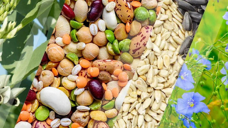
Researchers from ZHAW, Agroscope, and FiBL are investigating how legumes and oilseeds like soybeans and flax can contribute to a more sustainable Swiss food system. A shift to a more plant-based diet and food production is urgently needed. But what does this mean for consumers and farmers, and how…
current, 04/2025 - 03/2029
-
Data-based Screening and Monitoring Methods for Tracking Environmental and Social Dynamic around Gold Mines
Client demand for sustainable gold keeps rising. As a lack of reliable data makes sourcing responsible gold very challenging, we propose a data-driven process for ESG-oriented screening and monitoring using a combination of satellite, spatial and textual data and analytics. The project develops…
expired, 01/2024 - 06/2026
-
Tech4SDG – Guiding Swiss Asset Managers towards High-Impact SMEs
High-impact, social SMEs remain broadly unknown to impact investors and asset managers due to limited information and identification problems.To overcome the asymmetry of information and provide reliable guidance to Swiss asset managers, we aim to create an automated big data platform for the…
expired, 09/2021 - 03/2023
-
Environmental and Social Assessment at Mine Sites using Remote Sensing and Geoinformatics
expired, 05/2021 - 12/2021
-
HistoRiCH: Historical river change – Planning for the future by exploring the mapped past
expired, 09/2020 - 08/2024
-
DeMo. Urban Ecosystems Design and Modelling: A spatial based approach to integrate habitats in constructed ecosystems
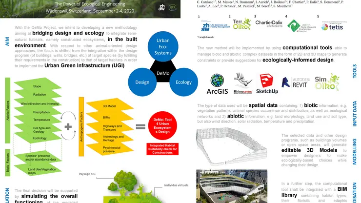
Strategic Subject Field Environment@N CampusLivingLab - Urban Ecosystems DeMo IUNR
expired, 01/2020 - 12/2022
-
Fighting bites with bytes: Promoting public health with crowdsourced tick prevention
Ticks are on the rise and transmit several infectious diseases, leading to serious illness or even death. The smartphone App “Zecke–Tick Prevention helps people, to remember the tick bite location and to check it for potential Lyme disease symptoms. In an interdisciplinary approach, ZHAW-scientists…
expired, 07/2019 - 12/2021
-
Digitisation in the outdoor facilities of Campus Grüental

Plant Search App
expired, 01/2019 - 12/2022
-
An integrated modelling and learning framework for real-time online decision assistance in Swiss agriculture
We are developing an agricultural risk decision assistant based on a unique model that can assess and visualize reliable weather and seasonal climate forecasts, soil data, and crop growth forecasts. Based on real-time and historical weather, climate, soil and crop data and novel learning algorithms,…
expired, 12/2018 - 11/2021
-
Regionalised Agricultural Life Cycle Assessment
The start-up financed project is a research cooperation of the research groups Life Cycle Assessment, Geography of Food and Geoinformatics for the development of a competence focus "Regionalised Agricultural LCA". The feasibility of a regionalised life cycle assessment will be examined with regard…
expired, 06/2018 - 01/2019
-
Multispectral imaging: key to early leaf disease detection
expired, 06/2017 - 02/2018
-
Wind energy potential in close proximity to the rail network of the Rhaetian Railway RhB

This applied research project aims to identify and prioritise suitable areas for wind energy production in close proximity to the railway network of the Rhaetian Railway AG. The study refers to the vertical wind turbine A32 of the Vertical Sky series (Agile Windpower AG). Wind conditions,…
expired, 06/2017 - 01/2018
-
Developing a new detection method for small mammals, focusing on small mustelids and dormice (TubeCam)
Habitat loss through settlement expansion and intensification of agriculture is becoming a major threat for many animal species. The populations of least weasels, ermine, polecats and pine martens in the Central Swiss Plateau are, according to uniform assessments by experts, understood to be in…
expired, 11/2016 - 10/2017
-
Wind energy potential in close proximity to the rail network of the Swiss Federal Railways SBB
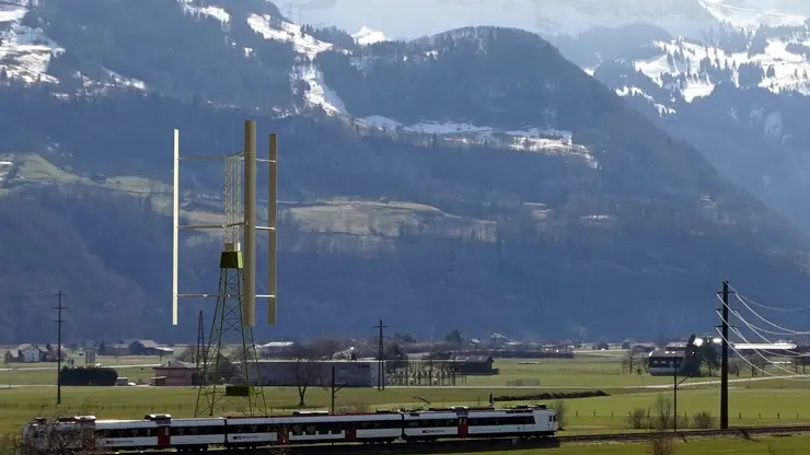
The wind energy potential in close proximity to the railway network of the Swiss Federal Railways SBB is analyzed and quantified with reference to the vertical turbines A32, A45 and A64 of the Vertical Sky series (Agile Windpower AG). Wind conditions, topographical restrictions and an extensive list…
expired, 04/2016 - 04/2017
-
Erosion in Alpine Areas
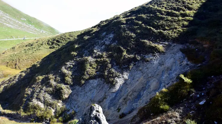
An ArcGIS® toolbox for the identification of cultivation induced Soil Erosion
expired, 04/2016 - 11/2017
-
Historizing GINES
Enabiling the management of mulit-temporal geodata within the Spatial Decision-Support System GINES
expired, 04/2016 - 07/2017
-
Spatio-temporal databases
Efficient Management and Analysis of large volumes of geodata in ecological monitoring
expired, 11/2015 - 07/2017
-
Global site assessment for hazelnut production
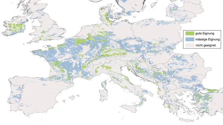
Feasibility and suitability analysis using CONSUS
expired, 11/2015 - 12/2016
-
Formation and future evolution of glacier lakes in Austria (FUTURELAKES)
Glacier retreat is one of the most visible consequences of climate change and models suggest that temperature increase of 3°C in Austria will lead to glacier extents less than 20% of today's extent within the next century. Information on future changes of the high alpine landscape is currently not…
expired, 01/2015 - 10/2018
-
CONSUS – A GIS tool for agricultural planning
The Institute for Environment and Natural Resources (IUNR) has developed a tool for the efficiently and strategically planning of production and procurement in the agricultural market. It assesses the suitability of sites worldwide for specific agricultural products on the basis of geographic…
expired, 07/2014 - 12/2021