CONSUS
A GIS tool for agricultural planning
At a glance
- Project leader : Dr. Roman Grüter, Isabel Jaisli
- Project team : Dr. Patrick Laube, Pascal Ochsner, Hanno Rahn, Sonja Trachsel
- Project status : completed
- Funding partner : Foundation (Syngenta Foundation for Sustainable Agriculture)
- Project partner : Syngenta Foundation for Sustainable Agriculture
- Contact person : Isabel Jaisli
Description
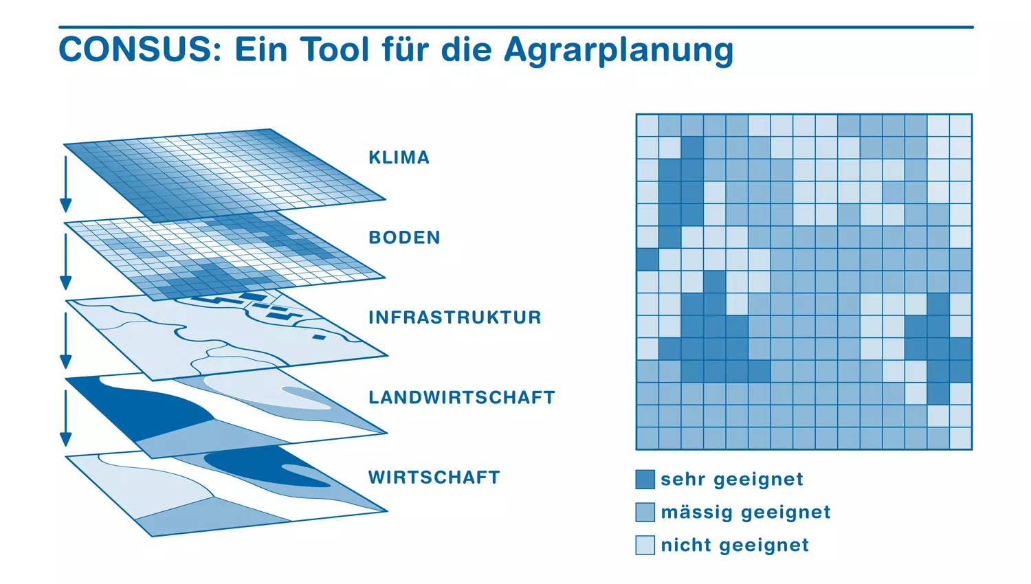
The Institute for Environment and Natural Resources (IUNR) has developed a tool for the efficiently and strategically planning of production and procurement in the agricultural market. It assesses the suitability of sites worldwide for specific agricultural products on the basis of geographic information on climate and soil as well as socio-economic and political criteria.
The CONSUS project focuses on the development of a model that takes into account the needs of (agricultural) companies, producers and rural development. CONSUS acts as (a) decision support system for agricultural enterprises and rural development; (b) it assess the sustainability, suitability and profitability of procurement and (plant) production facilities; and (c) assess the overall feasibility and added value of such facilities.
The results achieved during the project were as follows:
- Development and validation of the CONSUS model as an instrument for spatial suitability analysis for the production and procurement of agricultural raw materials.
- Toolbox for data processing in GIS
- Four databases for data processing
- Application of CONSUS in 3 case studies (soybeans in Rwanda, hate avocado in Guatemala and hazelnuts in Europe)
CONSUS (Connecting for Sustainable Sourcing) was developed as a
modular GIS-based decision support system for the production and
procurement of agricultural raw materials. The system extends the
classical FAO land assessment approaches by three specific
dimensions: (i) the sustainability dimension: The extended
suitability analysis goes beyond the purely biophysical suitability
and integrates ecological, economic and social suitability; (ii)
the spatial-temporal dimension: The inclusion of an adaptive global
cultural cycle model enables a hierarchical, multi-scale
feasibility assessment; (iii) the value-added chain: In the focus
of the suitability assessment, the The system was implemented as a
flexible workbench with knowledge databases, GIS toolboxes and
supporting data processing modules.
In the next few years (2016-2018) CONSUS is to be successively
developed, expanded and supplemented. Further projects and case
studies will facilitate processes and help to optimize the system
and its performance. As a first extension, we are developing a web
tool with interactive maps for selected crops to support the
marketing process of CONSUS. Customer-specific extensions, mobile
apps or related services could also open up further opportunities
for the development of the CONSUS.
Further information
Publications
-
Grüter, Roman; Trachsel, Tim; Laube, Patrick; Jaisli, Isabel,
2022.
Expected global suitability of coffee, cashew and avocado due to climate change.
PLOS ONE.
17(1), pp. e0261976.
Available from: https://doi.org/10.1371/journal.pone.0261976
-
Jaisli, Isabel; Laube, Patrick; Trachsel, Sonja; Ochsner, Pascal; Schuhmacher, Sarah,
2019.
Suitability evaluation system for the production and sourcing of agricultural commodities.
Computers and Electronics in Agriculture.
161, pp. 170-184.
Available from: https://doi.org/10.1016/j.compag.2018.02.002
-
Jaisli, Isabel; Laube, Patrick,
2015.
In:
Tackling World Food System Challenges: Across Disciplines, Sectors, and Scales, Ascona, 22. Juni 2015.
ZHAW Zürcher Hochschule für Angewandte Wissenschaften.
Available from: https://doi.org/10.21256/zhaw-3737