Geoinformatics Research Group
About us
The Geoinformatics Research Group focuses on the development, application and validation of innovative methods for processing and analysing spatiotemporal data on topics relating to the environment and natural resources. As a centre of excellence for industry-focused approaches to data, software and infrastructure, the Group provides solutions-based and customer-focused advice on the planning and implementation of geoinformatics projects.
Competencies
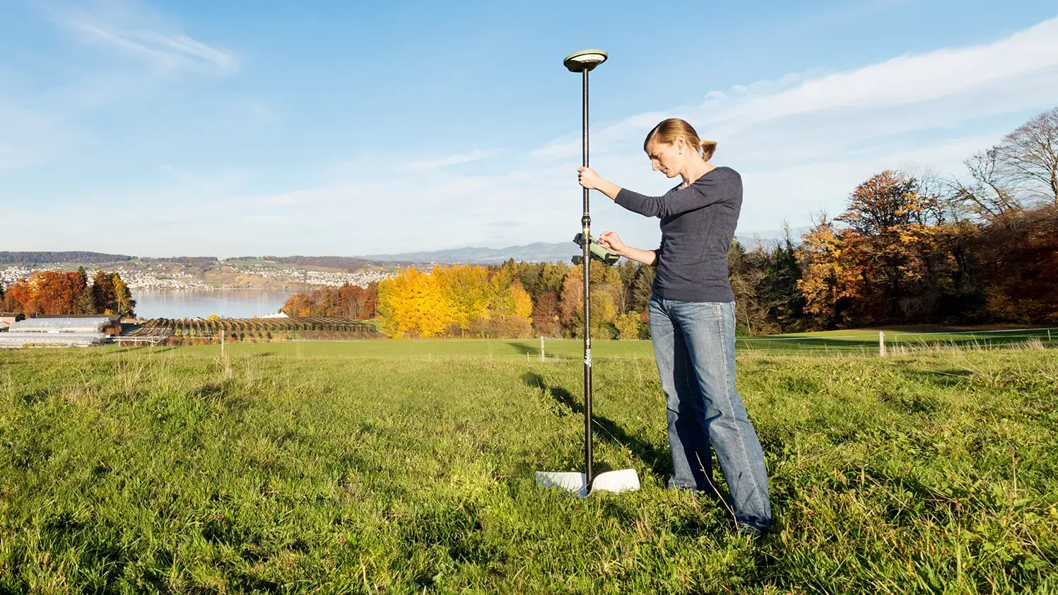
- Geospatial data collection (mobile GIS, drone-based short-range remote sensing).
- Design and maintenance of geodatabases and infrastructures
- Spatial analysis and spatial data science (suitability and multi-criteria analysis, location analysis)
- Programming and scripting for spatial analysis
- Cartography and Geovisualization
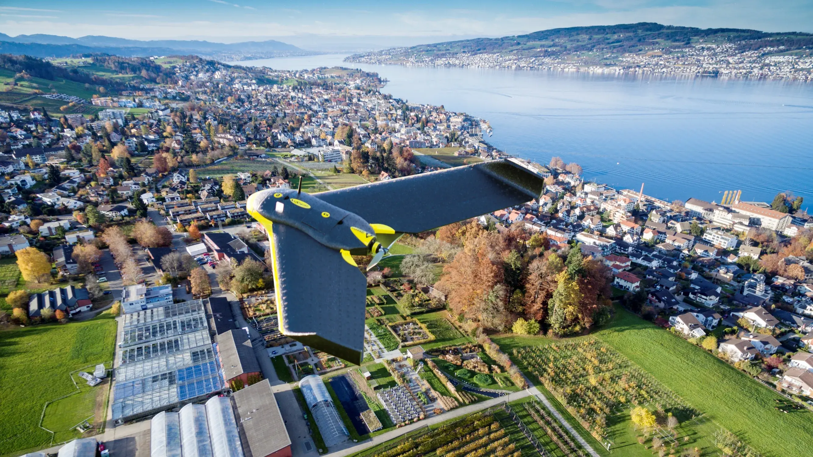
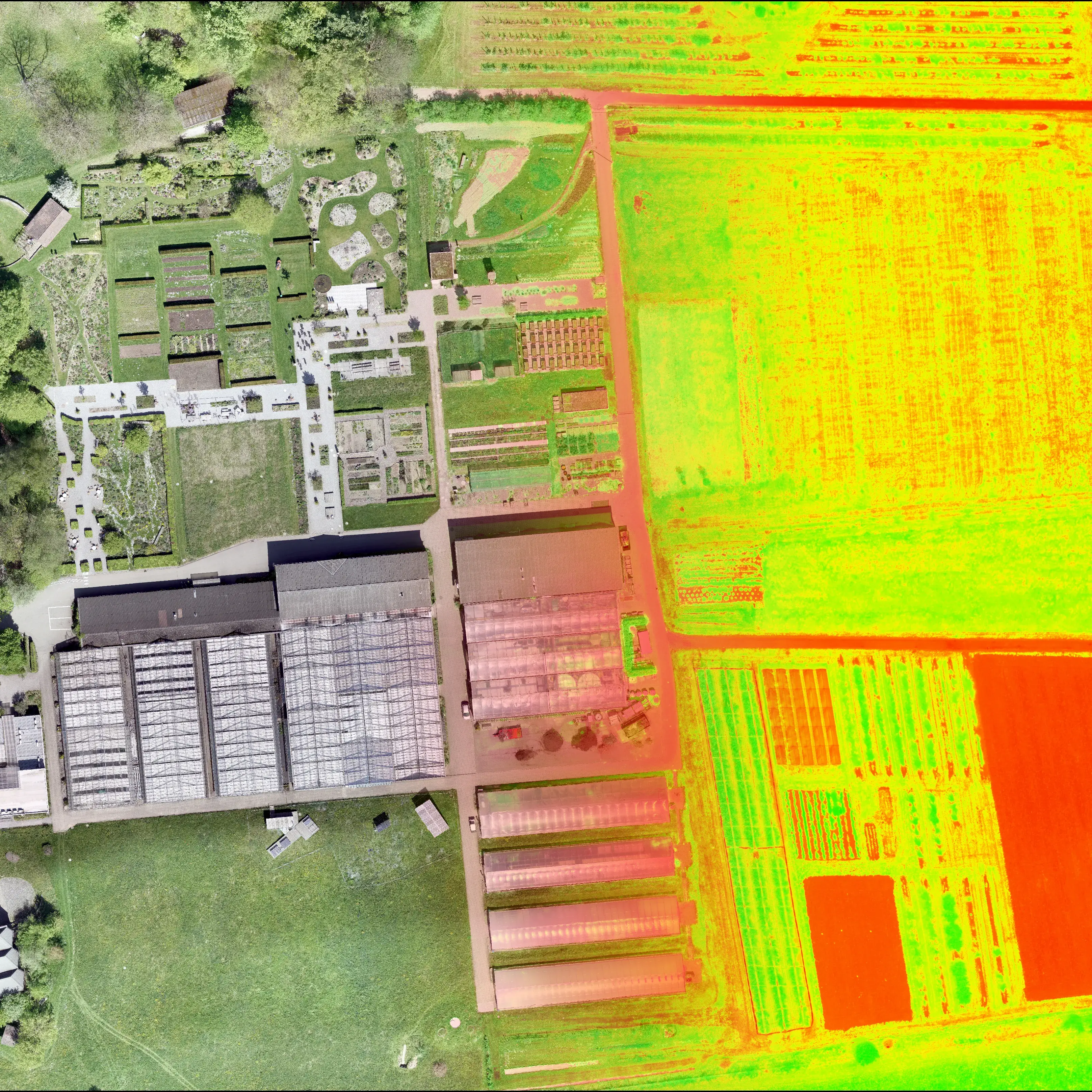
Geodata collection with drones
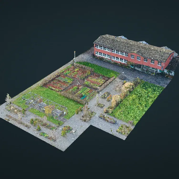
Drones are revolutionizing research, industry and everyday life. The Geoinformatics research group has a large number of modern drone systems at its disposal, which can be used to collect extremely high-resolution image data in terms of time and space. Possible applications range from the evaluation of 3D point clouds in urban areas to the creation of high-resolution vegetation indices for modern agriculture. The evaluation and application of drone-based remote sensing is an integral part of the research and teaching portfolio of the Geoinformatics group.
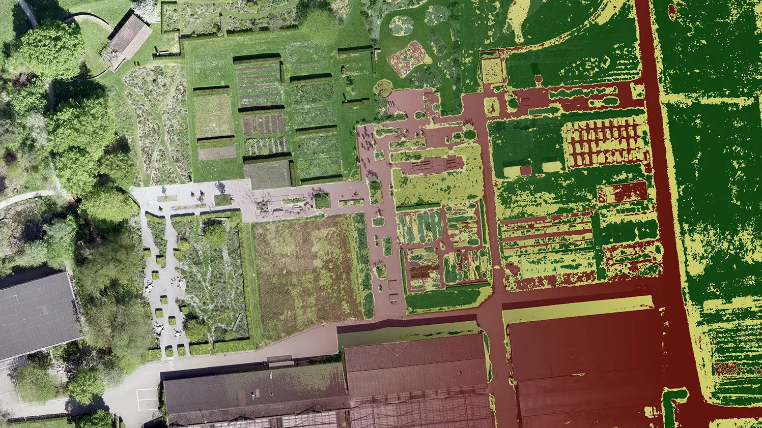
Ecological Monitoring
Understanding ecological processes requires the repeated acquisition of geospatial data in monitoring programs. The geoinformatics research group develops flexible workflows for the acquisition, enrichment, and analysis of spatiotemporal data for effective and efficient ecological monitoring. For this purpose, we combine self-collected geodata with publicly available spatial data.
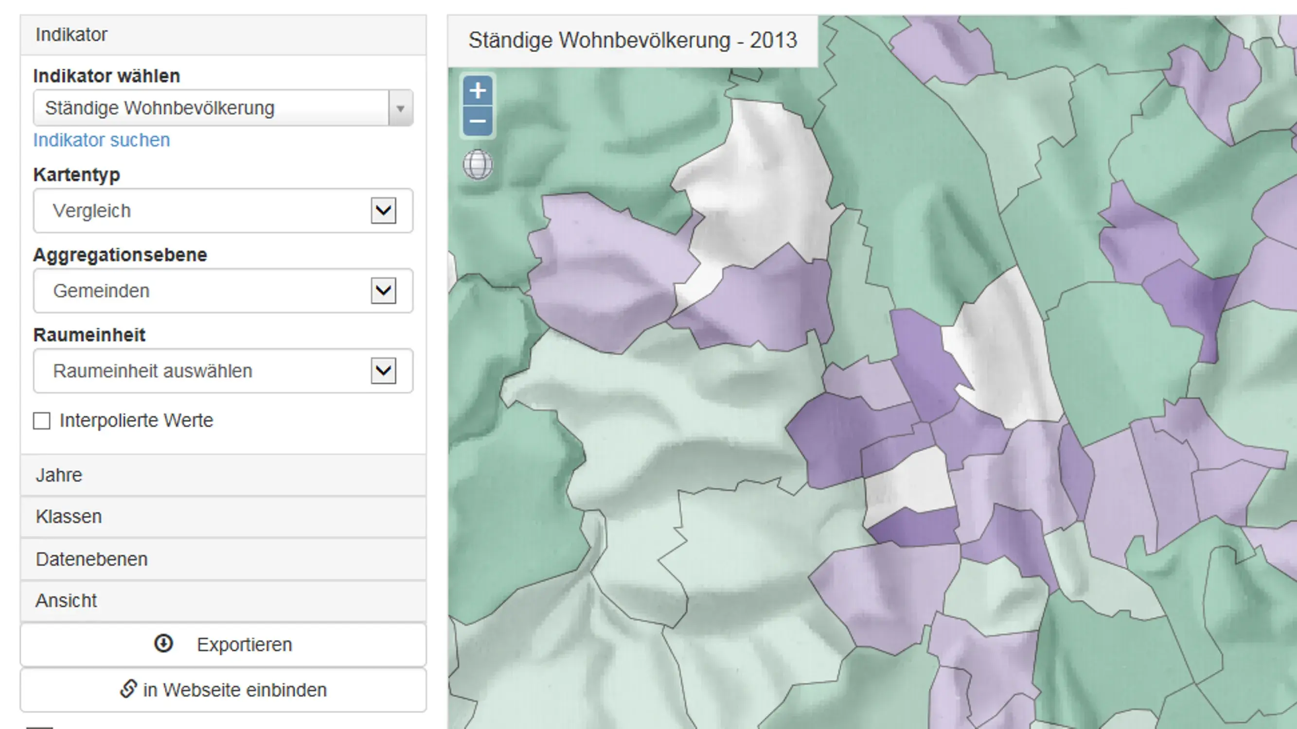
Multi-criteria analysis
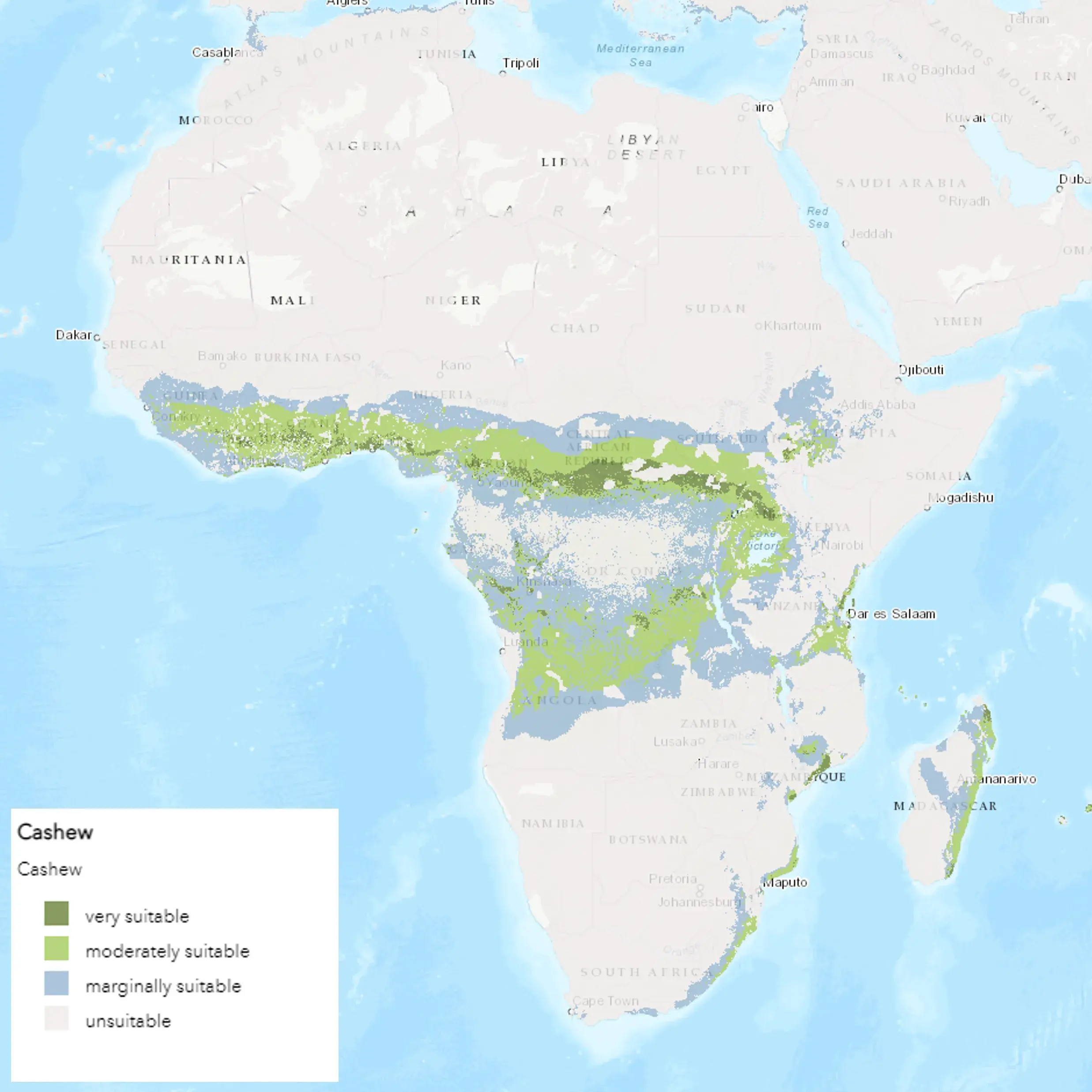
The great strength of Geographic Information Systems (GIS) lies in the combination of different data levels via a common spatial reference. In so-called multi-criteria analyses, we digitally map the most diverse properties of space and compute them into spatially differentiated suitability maps: Where is the best location for a new wind turbine? Where are the best cultivation sites for the superfood grain quinoa?
Spatiotemporal analysis and modeling
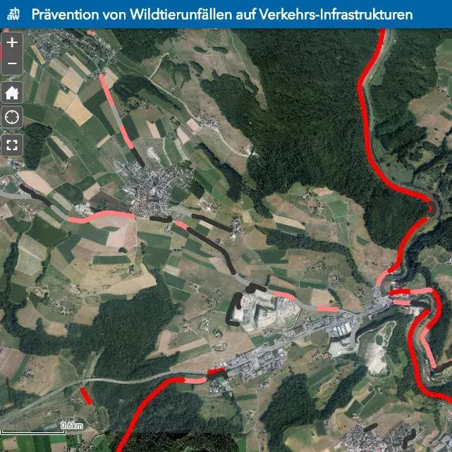
Ever increasing amounts of spatiotemporal information require the development of new Data Science methods. To this end, we combine methods of geoinformatics with machine learning and information visualization for the analysis and modeling of spatial processes. Applications range from the probability of accidents between cars and wildlife, to the risk of tick bites in forests, to valuation tools for sustainable investment in the financial sector.


This might also interest you
Continuing education
Find out about our wide offer on CAS and courses in continuing education.
IUNR research projects
Find out about the breadth of subjects covered by our Institute.
Study
Continuing education
IUNR research projects
Find out about BSc and MSc programmes at IUNR.
Find out about our wide offer on CAS and courses in continuing education.
Find out about the breadth of subjects covered by our Institute.