Dandelion-counting drones
Drone technology is used increasingly by institutions involved in environmental research, including the Institute of Natural Resource Sciences (IUNR). Within the framework of a feasibility study, aerial drone images were employed to determine precisely the number of dandelions blooming in a test field on the ZHAW Grüental campus.
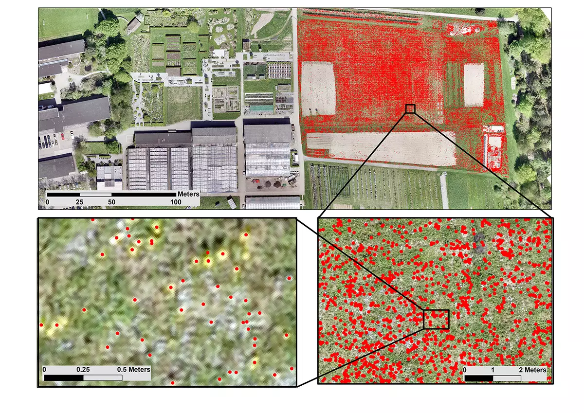
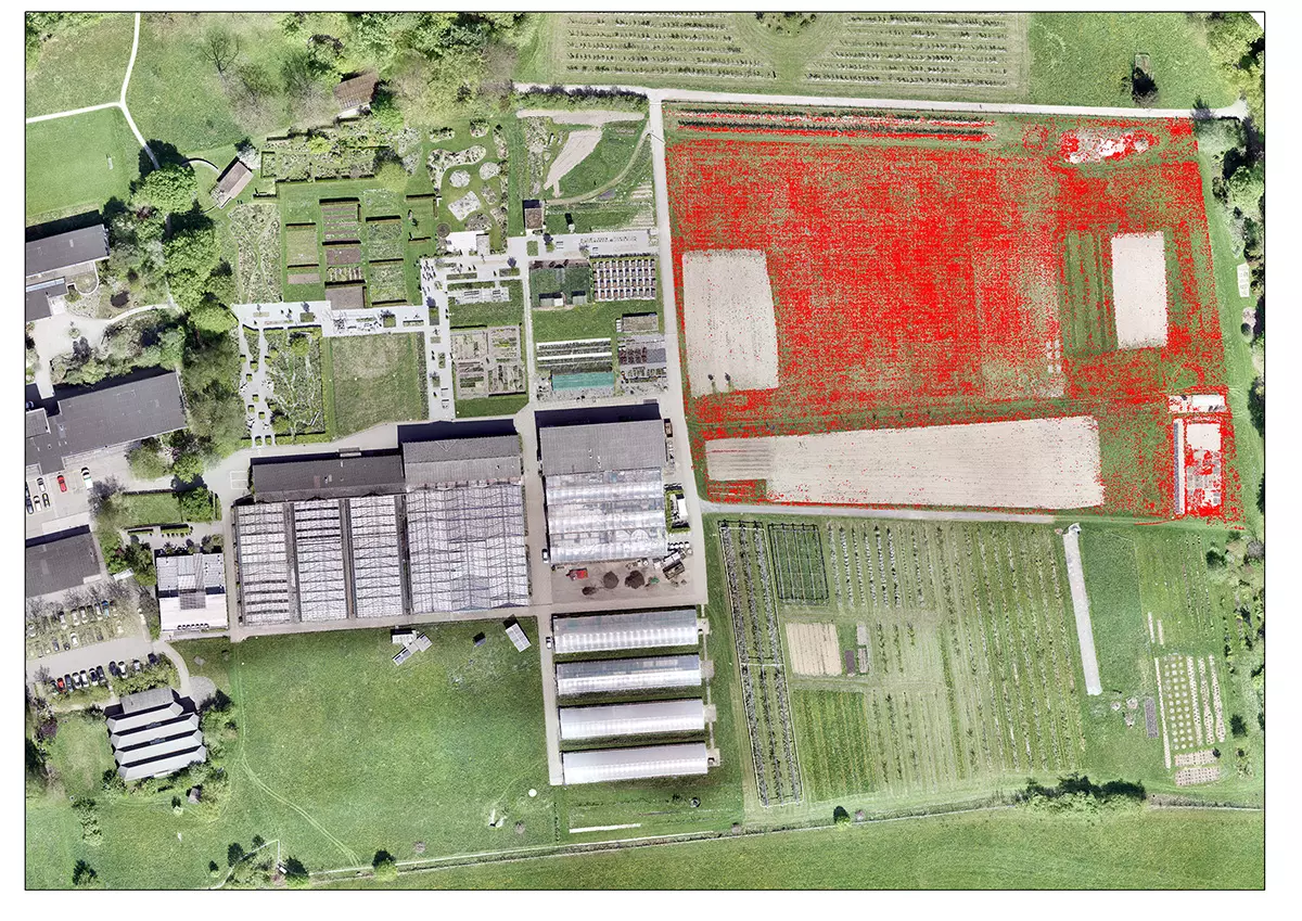
Johann Miller of the Research Group for Geoinformatics counted some 230,000 individual dandelion blossoms in a 1 cm resolution aerial photograph using supervised classification.
The ZHAW research group now maintains an extensive fleet of modern, unmanned aerial vehicles (UAVs) to utilise ground-breaking technological developments in data gathering and analyses.
Drones are currently being used in a multitude of research projects at the IUNR, for instance for the ecological monitoring of riverscapes and meadowlands and to investigate the correlation between glacial melting and vegetational development in high alpine glacier fore fields.
Advantages over satellite imaging
These drones are equipped with various sensors and able to record three-dimensional terrain models, high-resolution aerial images, surface temperatures and information relating to vegetation for further analysis. The main advantages of this method over, for instance, satellite data or plane-based imaging are both the temporal and spatial flexibility associated with the data gathering and the comparatively low costs.
Other future fields of application for drone-based research in Geoinformatics include the ecological assessment of natural and built environments as well as the monitoring of the environmental sustainability of building processes and digitalisation in agriculture.